The Results of Our Stormwater GIS Assessment
These are just a sampling of the results we've helped our customers achieve
-
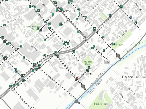
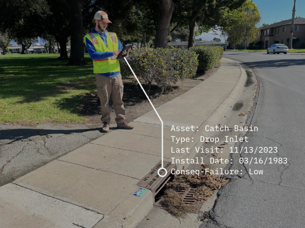
 Ensuring precise and comprehensive GIS-based mapping of stormwater assets.
 -
 Streamlining the process of regulatory compliance and reporting with GIS.
 -
 Adopting a GIS-centric approach for effective watershed and catchment area management.
 -
 Leveraging GIS to accurately quantify and improve water quality outcomes.
 -
 Enhancing public asset maintenance with data-driven GIS insights.
 -
 Utilizing GIS for forward-thinking, resilient stormwater management strategies.
 -
 Making informed, geography-based capital investment decisions through GIS analysis.
 -
 Incorporating GIS into community engagement programs for more impactful stormwater initiatives.
 -
 Leveraging GIS data to advocate effectively for necessary stormwater funding.
How Does the Free Assessment Work?
Our Free GIS Assessment is a structured and comprehensive process designed to enhance your stormwater management strategies.
Led by our team of GIS and stormwater management experts, this step involves an unbiased review using our MS4 Program Assessment Framework. We'll thoroughly assess the essential aspects of your stormwater program and its integration with GIS, identifying opportunities for enhancement.
An in-depth conversation will focus on your specific objectives and aspirations. Whether aiming for regulatory compliance, improved sustainability, cost savings, or a combination, our assessment will be tailored to your needs.
We'll provide actionable insights and practical advice based on the assessment and your goals. You'll receive targeted recommendations to elevate your stormwater management program, meet your objectives, and tackle any challenges.
We don't just leave you with insights and recommendations; a follow-up meeting ensures you fully understand and can implement them. This session lets your team clarify questions and discuss the pathway to integrating these strategies.
The assessment is completely free of charge. If you decide to proceed with our recommendations, our team can provide ongoing support, helping you integrate these changes effectively and maximize your GIS infrastructure's impact.
We aim to deliver insights and a clear, actionable pathway forward, empowering your stormwater management with practical, effective GIS strategies.
"The assessment process proved to me that this is software built by stormwater professionals and not a software company fishing for a product fit. It was valuable to discuss the strategy our stormwater program will be using with people who understand stormwater program management."
James
Who Our Free Stormwater GIS Assessment Is For
Local Governments
Empower your municipality with advanced GIS strategies tailored for urban stormwater management. Benefit from detailed insights into how GIS can optimize everything from flood mitigation to water quality monitoring, aligning with local environmental goals and regulations.
Special Districts
Special districts focused on water resources, flood control, or environmental conservation will find our assessment particularly valuable. We provide specialized GIS strategies that enhance your district's operational capabilities and resource management, aligning with your unique environmental stewardship missions.
State Departments of Transportation (DOTs)
For DOTs, managing stormwater runoff effectively is critical for environmental protection and infrastructure maintenance. Our assessment provides tailored GIS solutions that address the challenges of integrating stormwater management with transportation infrastructure, aiding in compliance and sustainability.
Universities with MS4 Permits
Academic institutions can leverage our assessment to enhance campus-wide stormwater management strategies. You can use our insights to meet MS4 permit requirements and to integrate practical, cutting-edge GIS applications into your environmental and urban planning curriculum.
Take Your MS4 Program To The Next Level
This assessment is not just about using GIS tools; it's about transforming your approach to stormwater management through the smart application of GIS technology tailored to your community's unique needs and challenges.

Effectively Use GIS
Leverage the power of Stormwater GIS technology. Organize all essential data into a comprehensive and reliable single source of truth using GIS. Lay the foundation for more efficient data collection and information management, opening up a world of data driven decision-making.

Streamline Compliance
Adopt digital tools and efficient workflows to reduce the time and complexity of keeping up with regulatory requirements. Efficiently use data to prioritize compliance tasks, painlessly summarize program accomplishments, and reduce the drudgery of demonstrating regulatory compliance.

Increase Resiliency
Focus resources and energy on going beyond effort-based compliance and set your sights on building local resilience. Help lead your community's preparation and adaptation to the changing climate and its associated challenges. Implement strategies to withstand extreme weather events, increased local flood hazards, and other climate-related stressors.
Who Typically Participates
Our Free Stormwater GIS Assessment is specifically designed for those at the forefront of managing and improving municipal stormwater systems. It's an ideal resource for:
Stormwater Managers
If you oversee a stormwater management program's effectiveness, compliance, and efficiency, this assessment is for you. We provide the assessment tools and insights to enhance your strategies and decision-making processes, ensuring your program meets regulatory standards while optimizing resource allocation.
GIS Professionals
GIS experts who support stormwater management efforts will find our assessment invaluable. We delve into the stormwater-related applications and data governance aspects of your ArcGIS implementation. This assessment helps you leverage ArcGIS technology to its fullest potential.
Engineers
Engineers play a critical role in the practical aspects of stormwater management, from infrastructure design to implementation. Our assessment equips engineers with GIS tools and insights crucial for designing and managing efficient stormwater systems.
Data Managers
As key players in managing and analyzing stormwater data, data managers will find our assessment essential. It offers strategies to optimize data accuracy and utility, ensuring your data effectively supports stormwater management decisions and annual reporting requirements.
Public Works Officials
Our assessment provides a clear pathway for those involved in public works management who are looking to integrate more effective GIS solutions into their stormwater management plans. We help you understand how GIS can be a game-changer in managing urban water systems more efficiently and sustainably.
Environmental Planners and Engineers
Our assessment also benefits environmental planners and engineers seeking innovative ways to address stormwater challenges. We offer insights into how GIS can aid in developing more effective, environmentally friendly stormwater solutions.
Who Are We?
At 2ndNature, we're more than just a team – we're innovators, environmental stewards, and problem-solvers deeply committed to transforming how communities manage stormwater. Our journey began with a simple yet profound belief: the right combination of technology, applied science, and practical application can revolutionize stormwater management.
We bring together a diverse team of experts in GIS technology, environmental science, and stormwater management. Our professionals are not only skilled in their respective fields but are also passionate about creating sustainable, effective solutions for stormwater challenges.


